Welcome: Mputek (Fuzhou) Co., Ltd


sales@mputek.com
0591-83517896

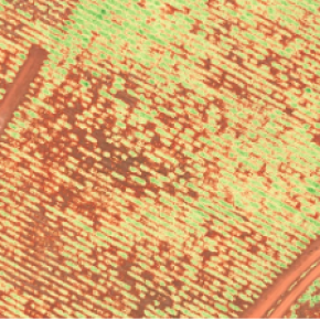
| carrying aircraft | DJI Mavic Pro |
| DJI Mavic Camera Mount | |
| AGL height | 370 feet (113 meters) |
| GSD (average) | 2.0in/px (5.2cm/px) |
| speed | 22mph (10m/s, 36kmh) |
| Measuring range | 70 acres |
| flight procedures | Drone Deploy |
| Front Overlap (App Settings) | 75% |
| Side Overlap (App Settings) | 72% |
| 85% |


Contact: Sam Lan
Phone: 13358250301
E-mail: sales@mputek.com
Whatsapp:+8613358250301
Add: 4th Floor,No.43,Section C,Software Park,Fuzhou,350003
We chat