Welcome: Mputek (Fuzhou) Co., Ltd


sales@mputek.com
0591-83517896
DJI Mavic 3M Multispectral Drone
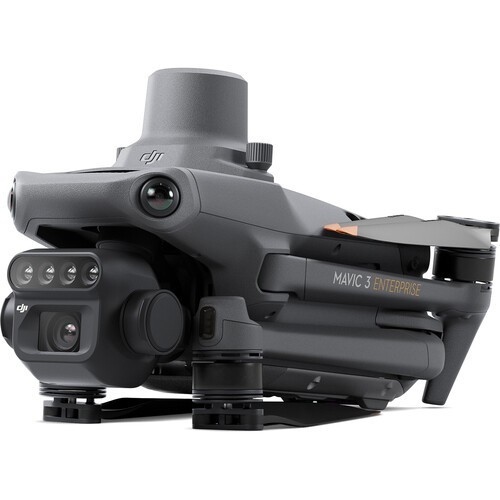
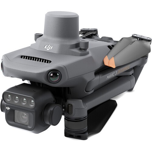
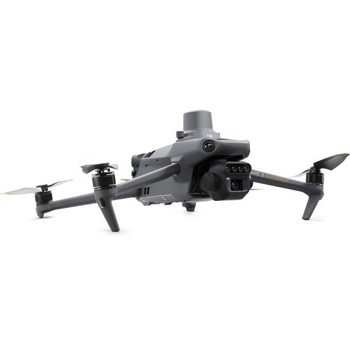
DJI Mavic 3 multispectral drone, in terms of fuselage appearance, DJI Mavic 3 multi-spectral drone has significant differences compared with other Mavic 3 series products, the fuselage is equipped with light intensity sensor and RTK module, camera In addition to the 4/3-inch 20-megapixel camera, there are four 5-megapixel multi-spectral lenses, which are 860nm±26nm near-infrared lens, 730nm±16nm red edge lens, 650nm±16nm red lens and The 560nm±16nm lens can realize high-precision navigation work.
Key Parameters:
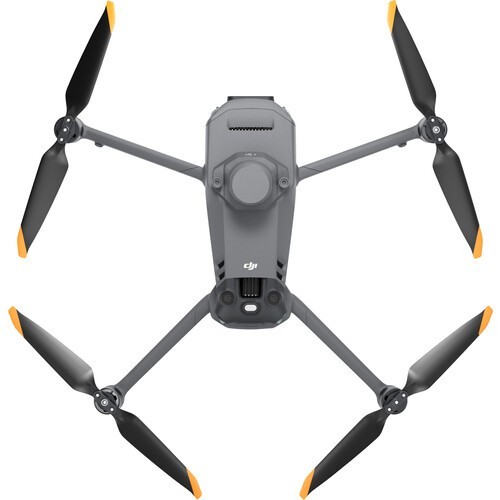
Small and portable - foldable and easy to store Highly integrated
multispectral camera-4*5MP G/R/RE/NIR
Visible light camera - 20 million pixels 4/3 CMOS, mechanical shutter
Safe and stable - omnidirectional obstacle avoidance [1], 15 km transmission distance [2]
Precise positioning - centimeter-level RTK positioning, microsecond-level time synchronization
Efficient aerial survey - 3,000 mu of farmland per sortie [3], 850 mu of mountain forest and fruit trees per sortie [3]
Applications:
1.Fruit Tree Aerial Survey

Using M3M to imitate the aerial survey of mountain forests and orchards, cooperate with DJI Maps or DJI Smart Agriculture Platform [7] to reconstruct the high-definition map of orchards, which can automatically identify the number of fruit trees, distinguish between fruit trees and obstacles, and can generate three-dimensional operation routes for agricultural unmanned aerial vehicles , the job is safer.
2. Guidance on precise variable operations

For rice fertilization, cotton chemical control, potato foliar fertilizer spraying and other links, use Mavic 3M to obtain multi-spectral images of crops, cooperate with DJI Map or DJI Smart Agriculture Platform [7] to generate NDVI vegetation index to capture crop growth Differences, generate prescription maps, cooperate with agricultural unmanned aerial vehicles to carry out variable fertilization and medication, reduce costs, increase production, and be green and environmentally friendly.
3. Intelligent Patrol

Mavic 3M can carry out automatic field patrol operations, and the field patrol images can be uploaded to the DJI Smart Agriculture Platform [7] through the 4G network in real time, so that abnormal situations such as lack of seedlings, weeds, and lodging in the field can be found in time, and cotton seedling emergence can also be completed by using AI recognition Intelligent analysis such as identification, rice and wheat yield measurement, etc., realize real-time sharing of crop growth information, guide farming activities, and easily manage thousands of acres of farmland by one person.
4. Environmental monitoring and natural resource survey

Mavic 3M can also be used in scenarios such as water eutrophication monitoring, forest distribution survey, urban green area survey and other environmental monitoring and natural resource surveys.
For more details, please contact:
Contact: Mr. Lan
Tel: 0591-83517896
Mobile: 13358250301
Email: sales@mputek.com
Address: 4th Floor, No. 43, Section C, Software Park, Gulou District, Fuzhou City, Fujian Province
Contact: Sam Lan
Phone: 13358250301
E-mail: sales@mputek.com
Whatsapp:+8613358250301
Add: 4th Floor,No.43,Section C,Software Park,Fuzhou,350003
We chat