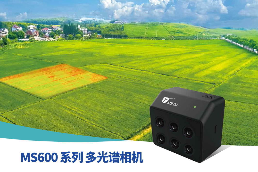
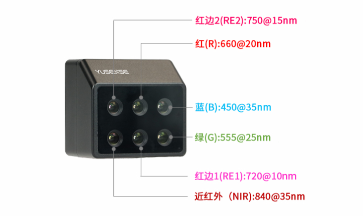
The MS600 camera has six spectral channels, 1.3M pixels, 1/3” chip, and the wavelength range is 450nm, 555nm, 660nm, 720nm, 750nm, 840nm, and supports customization in the range of 400-1000nm.
MS600 Series multispectral cameras:
6-channel multi-spectral camera, each channel adopts 1.2Mp high dynamic range global shutter, CMOS detector, a total of 17 bands in the range of 360nm~940nm are available for selection, with a variety of band configuration schemes, which can be deeply customized according to user needs.
Product advantages:
made in China
6-channel multi-spectral camera, produced by the Chinese Academy of Sciences team
spectral channel
17 kinds of wavelengths can be selected from 6 kinds, which can be freely selected
ingenious design
The photoelectric system has been fully upgraded to obtain spectral data faster and more comprehensively
.
Accurate acquisition
High-precision radiation calibration with real-time correction of ambient light radiation, more accurate spectral data
Intelligent dimming
High dynamic range sensor, real-time dimming with multi-target global optimization, improving the amount of original image information
high compatibility
Compatible with all multi-rotor and fixed-wing UAVs, fast integration, easy to use
data processing
Professionally customized data processing software Yusense Map, the results are issued faster and more efficiently
More wavelengths can be selected, and better wavelengths can be combined
400nm-900nm, 6 kinds of wavelengths can be selected from 17 kinds
Covering 80% of multispectral remote sensing application fields
6 optional wavelengths can be used in any combination
Data combination efficiency increased by more than 2 times
Ingenious design of photoelectric system
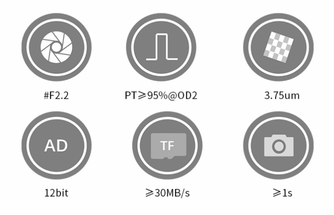
Large-aperture, low-distortion, achromatic imaging lens, accurate acquisition of ground feature information in the wide band range of 400nm to 900nm
Scientific-grade dielectric film narrow-band filter, the average out-of-band response is ≤1%, and the spectral information is more pure
3.75μm large pixel size, more effective light input when taking pictures, and higher signal-to-noise ratio
12bit digital quantization bit depth, more finely record the light intensity information of the target, and adapt to scenes with greater contrast
Data writing speed ≥ 30 MB/s, continuous photo interval ≤ 1s, meeting the needs of fixed-wing UAVs
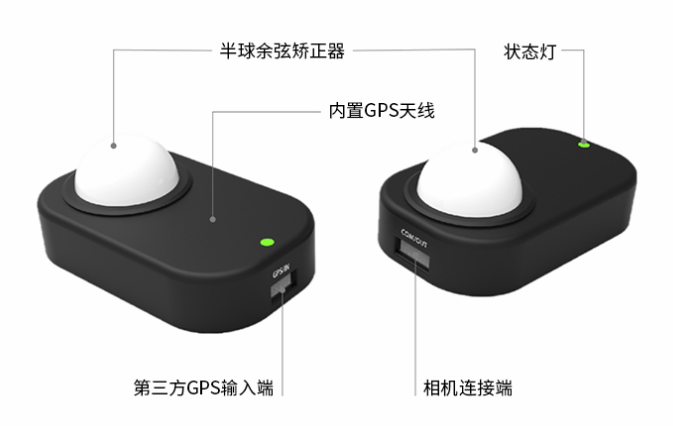
Accurately acquire spectral images
The downlink light sensor simultaneously acquires the ambient light irradiance corresponding to the wavelength of the 6 channels and records it in the corresponding TIFF image, ensuring that the user can obtain more accurate and real reflectivity of ground objects.
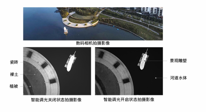
Intelligent real-time dimming
High dynamic range sensor, real-time dimming algorithm with multi-target global optimization, automatically judges the light intensity characteristics of the imaging subject, effectively suppresses local overexposure/overdarkness in high-contrast scenes, improves the amount of original image information, and satisfies users in different industries for various Application of remote sensing scenes of similar ground objects
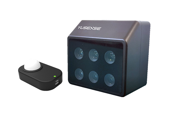
Features:
Downward Light Sensor (DLS)
Real-time ambient light radiation correction, effectively reducing the interference of light changes
Small size and light weight
Compact design, small size, the product weighs only 200 g
Common interface for easy integration
With standardized interface design, it can operate independently or quickly integrate with various drones
Portable operation, easy to use
Equipped with professional customization (MS600 Pro), one-key connection to mobile devices, intelligent camera control and data display
On-board computing, real-time image transmission
Built-in 4-core CPU module, on-board real-time processing and image real-time downloading two-in-one, support industry algorithm customization (MS600 Pro)
Technical Parameters:
| The main parameters | MS600 | MS600 Advanced | MS600 Pro |
| sensor | 1/3-inch CMOS; 1.2 megapixels; global shutter | ||
| Field of view | 43.6°HFOV;33.4°VFOV | ||
| Typical width | 96m*72m@h =120m | ||
| Ground Spatial Resolution (GSD) | 7.5cm@h =120m | ||
| [1] Band Range | 360nm~940nm(17选6:360nm、410nm、450nm、490nm、530nm | ||
| 555nm, 570nm, 610nm, 660nm, 680nm, 710nm (narrowband/high pass) | |||
| 760nm、800nm、840nm、900nm、940nm) | |||
| Data Calibration and Correction | High-precision spectral calibration, radiometric calibration, geometric correction; standard downstream light correction sensor | ||
| image storage format | 8/16 bit TIFF format | ||
| [2] Capture rate | Capture all channels at the fastest 1.5s/time | ||
| POS data | GPS positioning accuracy CEP 2.5m, 10-axis IMU | ||
| storage | up to 64G | ||
| interface | PWM | Serial port, 10/100/1000 | DJI-SKYPORT |
| ethernet、PWM | |||
| Data link | Only supports external trigger | support | support |
| Image transmission link | not support | support | Only preview images are supported |
| range of working temperature | -10°C ~ +50°C (relative wind speed ≥ 1 E22m/s) | ||
| trigger mode | External trigger, timing trigger, overlap rate trigger, manual trigger | Timing trigger, overlap rate trigger, manual trigger | |
| Voltage | 5.7V DC~17V DC | ||
| power consumption | 7 W average; 10 W peak | ||
| Dimensions (length * width * height) | 7 7mm x 72 mm x 47 mm | ||
| weight | 200 g | 200 g | 220 g |
| Environmental adaptability | Sapphire protection window, scratch-resistant, anti-wear, good durability | ||
| [3] Processing software | Yusense Map image processing software, compatible with Pix4D and other mainstream software, data support access to cloud platform | ||
| controlling software | Accessible by any WIFI device | Open API protocol supports secondary development | [4] Yusense Fly ground station APP |
| WEB interface, support Chinese and English | |||
| Channels and after-sales | Completely independent intellectual property rights, complete industry solutions, and comprehensive technical support | ||
[1] Within the range of 360nm~940nm, wavelength customization of each channel is supported, and the bands corresponding to the underlines are the default standard configurations, please consult us for custom fees for other band combinations.
[2] Capture rate varies depending on SD memory card write speed.
[3] Processing software Yusense Map and Pix4D are paid software.
[4] Yusense Fly ground station APP is free to use.
made in China
Contact: Sam Lan
Phone: 13358250301
E-mail: sales@mputek.com
Whatsapp:+8613358250301
Add: 4th Floor,No.43,Section C,Software Park,Fuzhou,350003
We chat
